Every corner of Zimbabwe
Eight iconic destinations — from UNESCO wonders to wild frontiers.
Zimbabwe at a glance
Hover or tap a pin to preview a destination — click to open.
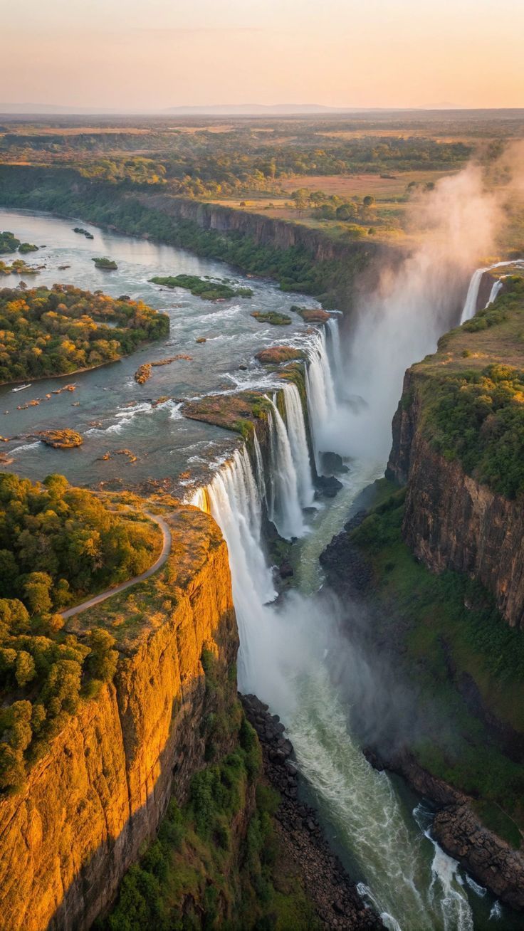
Long sacred to the Tonga, Toka and Lozi people as 'Mosi-oa-Tunya' (the smoke that thunders), the Falls were first documented by a European on 16 November 1855 when David Livingstone, paddled by Makololo guides to a small midstream island, named them after Queen Victoria. Designated a UNESCO World Heritage Site in 1989, they are also one of the Seven Natural Wonders of the World.
Victoria Falls
4.9Matabeleland North
UNESCO World Heritage Site. The largest curtain of falling water on Earth — 1.7km wide, 108m drop.
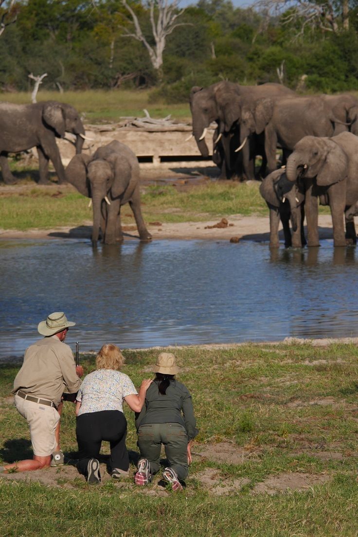
Once the royal hunting ground of the Ndebele warrior-king Mzilikazi in the 19th century, Hwange was proclaimed a Game Reserve in 1928 by Ted Davison, who became its first warden. Promoted to National Park in 1961, it has no natural surface water in the dry season — an extensive network of pumped boreholes (today solar-powered) sustains the wildlife on what is otherwise Kalahari sand.
Hwange National Park
4.8Matabeleland North
Zimbabwe's largest park (14,651 km²). Home to 40,000+ elephants and the Big Five.
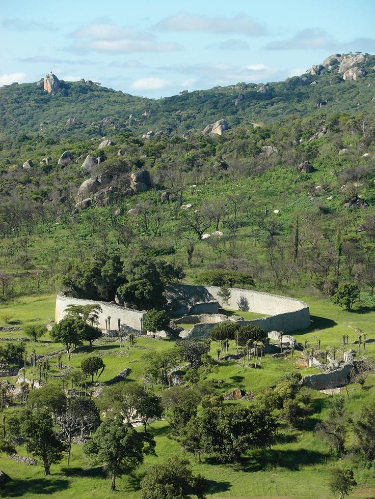
Built by ancestral Shona between roughly 1100 and 1450 AD, Great Zimbabwe was the capital of a powerful trading kingdom that exported gold and ivory as far as China and Persia — Ming dynasty porcelain and Arabian glass have been excavated on site. Its dry-stone walls, raised without mortar, gave the modern nation its name ('dzimba dza mabwe' — houses of stone). UNESCO listed it in 1986; the eight soapstone Zimbabwe Birds discovered here are the country's national emblem.
Great Zimbabwe
4.7Masvingo
UNESCO Site — the medieval Shona kingdom's stone city, 11th–15th century.
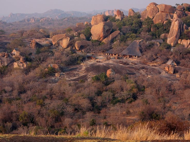
The Matobo Hills have been continuously inhabited for over 500,000 years and hold one of the world's richest concentrations of San rock art — over 3,000 sites painted across 13,000+ years. Sacred to the Mwari religion and burial place of King Mzilikazi (1868) and Cecil John Rhodes (1902) at his chosen 'View of the World', the area was declared a National Park in 1926 and a UNESCO Cultural Landscape in 2003.
Matopos National Park
4.7Matabeleland South
UNESCO landscape of granite kopjes, balancing rocks and the world's densest leopard population.
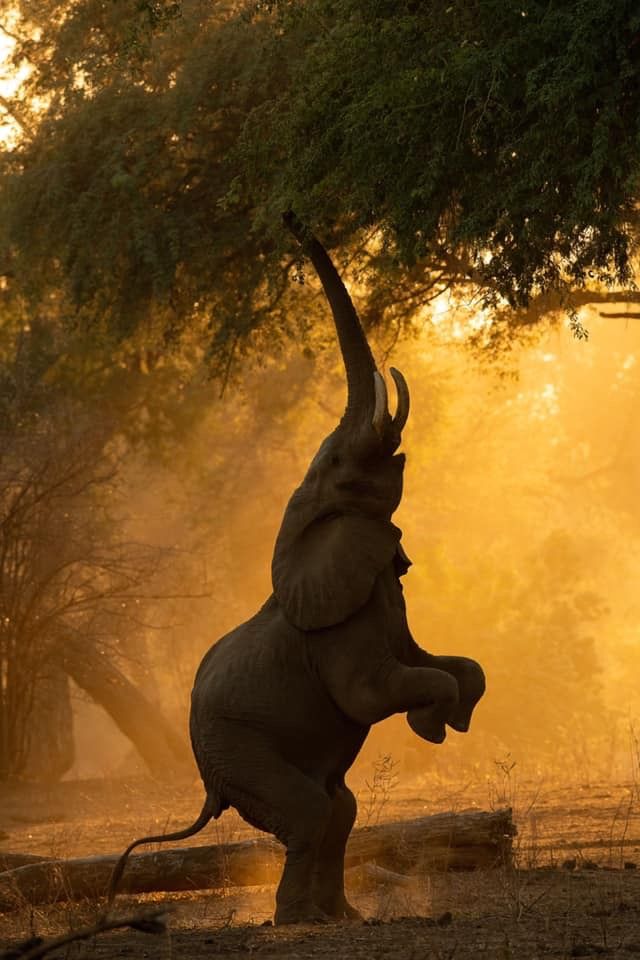
'Mana' means 'four' in Shona — for the four large pools left behind when the Zambezi shifted course thousands of years ago. Established as a National Park in 1975 and inscribed by UNESCO in 1984, Mana is one of very few African parks where visitors are permitted to walk and canoe unaccompanied. Made world-famous by the BBC's 'Dynasties' which followed wild dog 'Tait' and her family, and by photographer Nick Brandt's iconic 'Boswell' — the bull elephant who stands on his hind legs.
Mana Pools
4.9Mashonaland West
UNESCO wilderness on the Zambezi — wild dogs, elephants on hind legs, canoe safaris.
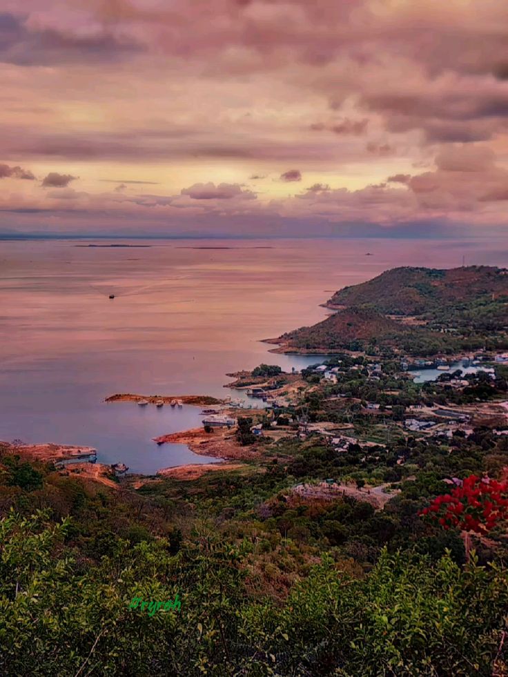
The Kariba Dam was built between 1955 and 1959 across the Zambezi's Kariba Gorge — at the time the largest dam ever attempted. Some 57,000 BaTonga people were displaced from their ancestral lands; in parallel, 'Operation Noah' (1958–64), led by Rupert Fothergill, rescued more than 6,000 wild animals from the rising waters. Today's lake is 226 km long, 40 km wide and one of the world's largest reservoirs by volume.
Lake Kariba
4.8Mashonaland West
World's largest man-made reservoir — 280km of houseboat sunsets and tiger fishing.
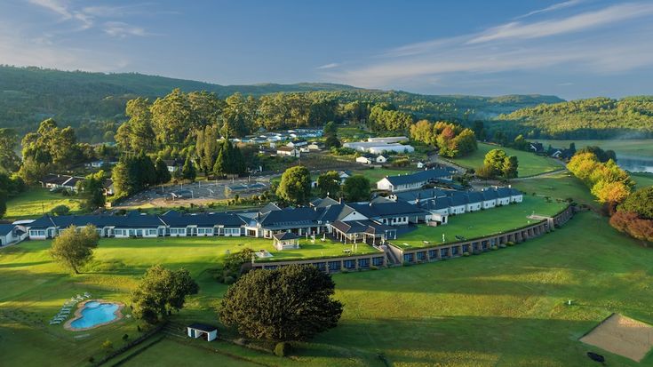
Stretching 300 km along the Mozambique border, the Highlands rise from sub-tropical lowveld to Mount Nyangani (2,592 m), Zimbabwe's highest peak. The Manyika people farmed these mountains long before Cecil Rhodes built his retreat at Nyanga in the 1890s; the area's stone-walled terraces, pit dwellings and iron-smelting furnaces date back to the 14th century. The 762 m Mutarazi Falls — the second-highest waterfall in Africa — plunges off the escarpment into Honde Valley.
Eastern Highlands
4.7Manicaland
Misty mountains, tea estates and Zimbabwe's tallest waterfall (Mutarazi, 762m).
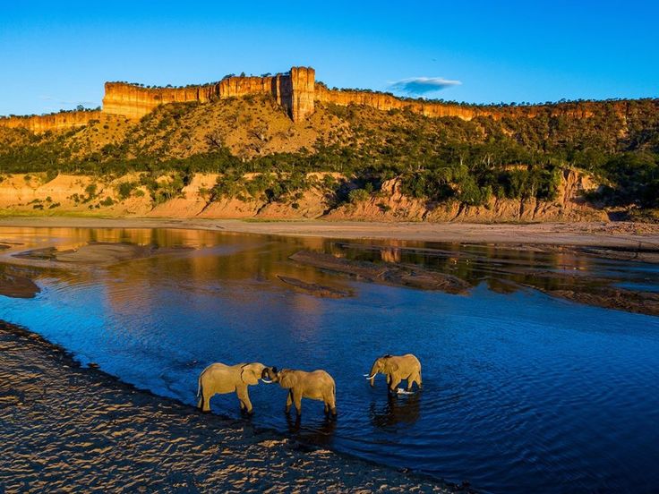
'Gonarezhou' means 'Place of Many Elephants' in Shona — a name earned through centuries of co-existence between the Shangaan people and great herds. Proclaimed a National Park in 1975 and joined to South Africa's Kruger and Mozambique's Limpopo to form the 35,000 km² Great Limpopo Transfrontier Park in 2002. Once heavily poached during the war years, conservation since 2007 (Frankfurt Zoological Society partnership) has seen elephants rebound to over 11,000 and the return of wild dogs and cheetah.
Gonarezhou
4.6Masvingo
'Place of Many Elephants' — red Chilojo Cliffs and Zimbabwe's wildest park.